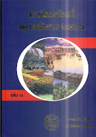
 I have been looking through the online book list of the Department of Provincial Administration (DOPA), which seem to mostly contain legal texts or handbooks for the officers in the provines. But I also found a two-volume book named ทำเนียบท้องที่ (local directory), which in fact is nothing but a complete list of the central administrative entities down to village level published in 2003. It can be both viewed online (volume 1, volume 2) or downloaded (volume 1, volume 2). However actually the download links are quite broken - the link for volume 2 returns volume 1, but some pages are in strange ordering; the link for volume 1 returns a part of volume 1, so volume 2 is only readable page by page from the first links.
Quite usable would be the map of subdistricts for each province, but sadly either the print or the subsequent scan make it hard to recognize much. More handy are the tables of entities for each of the province - including the area of each district with an accuracy of 0.01 km², and of course the list of the villages. But the problem is that the online book is the scan of a printed book, so I would have to type in all the names again, an impossible task for more than 60,000 villages. That's why I want a digital village list. If they had put online the source of the printed book - a PDF with copy-and-pasteable text - it would be much better. Not only the size of the file would be much smaller - the file is 75 MB - and it would be allow the contents to be reused. So I can only hope they'll make a new edition of this book already 5 years old, or even better than a PDF, they put the actual data online as Excel sheets or simple plain text files. Excel sheets would also help to spot mistakes as they can calculate the sums automatically - copying the data from a few province I have already spotted two mistakes in the tables.

No comments:
Post a Comment