From time to time I search for the words like "tambon" not only in Google, but also in Amazon, especially in case their search inside books might return something Google Books does not have yet. That way I stumbled upon a book titled "Subdivisions of Thailand: Monthon, Provinces of Thailand, Amphoe, Administrative Divisions of Thailand, Thesaban, Tambon, Boriwen, Sukhaphiban", which looked like it have exactly the content I am interested about. But when reading the description in more detail I noticed that this book is nothing else but the Wikipedia articles from the category Subdivisions of Thailand printed. Looking around more, there are thousands of similar books from the same publisher with different sets of Wikipedia articles placed together, each printed individually as a Print on Demand book, but each having a unique ISBN number already.
Now this is all perfectly legal, provided that they follow the license of Wikipedia and cite the source correctly. And even though I have written the articles within that specific book myself to a great deal, I don't recommend anyone to buy this book - first I know that the Wikipedia articles are way from complete, there are still lots of points I would love to add if only I could get them researched well enough. When you order the book, you also have no control on which version of the article will be used, most probably the current one, but how to be sure that that version is clear from any vandalism? Also, the price of about 15 US$ for just 52 pages is IMHO way overpriced, especially as not a single cent goes to the author unlike it would in any normal authored or edited book, the only cost they have is the pure printing and shipping.
The best way to use Wikipedia is to read online, as that's the only way to get the latest version of the text, have the ability to check older versions if some part seems dubious and smells of vandalism, be able to interact using the discussion pages or even change the text yourself if necessary. But for those book lovers who prefer to read in actual paper versions, or to be able to read where no internet is available or to create for a technophobe friend there's a great way to get your custom-made book. For quite some time already, Wikipedia has added ways to export article collections as a PDF file as well as get a Print on Demand book. Within few minutes I have reproduced the same contents as the above cited book, which would cost you just 8.90 US$ - and can also alternatively be downloaded as a PDF to print yourself or put in your eBook reader. Too bad that this book won't become a bestseller for sure - even if I would get the six dollar price difference I won't become rich.
Friday, October 29, 2010
Wednesday, October 27, 2010
Enclave Mueang
Few weeks ago, a new German book on Thailand titled "Kleine Geschichte Thailands" was published, written by Professor Volker Grabowsky, whom I already knew as the editor of the anthology "Regions and national integration in Thailand". As it is written for a non-academic audience, I did not expect to learn much new from it, but already the first pages had a very interesting speciality of the administration at the beginning of the 20th century.
Die politische Zugehörigkeit eines müang hing von den herrschaftlichen Bindungen der dort lebenden Bevölkerung ab. So gehörte der 40km südlich der Stadt Chiang Rai gelegene Distrikt (amphoe) Phan noch zu Beginn des 20. Jahrhunderts als Enklave verwaltungstechnisch zu Müang Lamphun. Phan war nämlich in den 40er Jahren des 19. Jahrhunderts von Siedlern aus Lamphun erschlossen worden, die auch nach der Auswanderung weiterhin ihrem alten Patron, dem Herrscher (cao müang) von Lamphun unterstanden. Diese Bande wogen stärker als geographische und wirtschaftliche Faktoren, die eine Zugehörigkeit von Phan zu Chiang Rai nahegelegt hätten.Now as most of my readers don't understand German, and trying to translate the above with Google translate will only create garbled nonsense, here's my translation of this paragraph.
The political affiliation of a mueang depended on the stately dependencies of its population. For example, the district Phan located 40km south of the city Chiang Rai, at the beginning of the 20th century formed an enclave and belonged administratively to Mueang Lamphun. Phan was founded in the 1840s by settlers from Lamphun, who after their emigration kept their relationship with their old patron, the ruler (chao mueang) of Lamphun. This relationship was stronger than geographical and economical factors, which would have suggested Phan to be a subordinate of Chiang Rai.The oldest mention of any changes for Phan district in the Royal Gazette that I am aware of is from 1912, when the minor district Mueang Phan was upgraded to a full district [Gazette].
Monday, October 25, 2010
Red dot in Google Earth
In a thread at the ThaiVisa forum - which I only noticed because a friend of this blog guided the readers here for more detailed information - the question came up what the red dot in Google Earth found for every Tambon is supposed to mean.

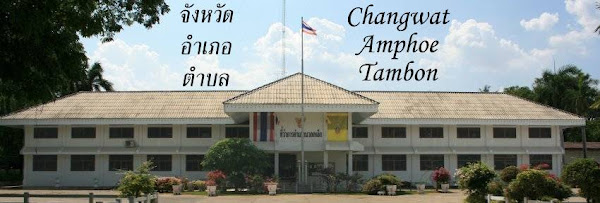
The above screenshot shows the area around the office of the subdistrict municipality Wat Pradu (เทศบาลตำบลวัดประดู่), located between Surat Thani city and Phunphin. The yellow marker is from my collection of office locations, and as I have passed the office several times I can even show a photo of the office complex - though a not that good one as I was on the wrong side of the big highway. One can see well that the red dot for Wat Pradu is located almost exactly on the office buildings as well. And when looking at the same area in Google Maps, instead of the red dot the name of the subdistrict shows up at the same location.
If this were the case for every Tambon I would have no problem to get XML full with all the locations, and it would be boring to write about these dots. For another office close by, the TAO Bang Chana (องค์การบริหารส่วนตำบลบางชนะ), Google places its dot into a palm plantation in the north of the subdistrict, whereas the placemark in Longdo Map points to an actual building in the very south. Though it is close to the city Surat Thani I haven't been able to verify that location yet, but in this case I believe the Thai map of Longdo much more than Google.
Another thing is that it seems Google has exactly one red dot per subdistrict, so they cannot correspond to the local government units exactly - there are subdistricts with two of them, for example Khanom subdistrict, Khanom district, Nakhon Si Thammarat has both a subdistrict municipality and a TAO, and the red dot points near the district office but nowhere near neither of the two local government offices. and for Talad subdistrict within the city of Surat Thani the red dot is within a private villa, even though there is no administrative office for this subdistrict at all. I'd be curious where did Google get the coordinates for these placemarks at first...
The above screenshot shows the area around the office of the subdistrict municipality Wat Pradu (เทศบาลตำบลวัดประดู่), located between Surat Thani city and Phunphin. The yellow marker is from my collection of office locations, and as I have passed the office several times I can even show a photo of the office complex - though a not that good one as I was on the wrong side of the big highway. One can see well that the red dot for Wat Pradu is located almost exactly on the office buildings as well. And when looking at the same area in Google Maps, instead of the red dot the name of the subdistrict shows up at the same location.
If this were the case for every Tambon I would have no problem to get XML full with all the locations, and it would be boring to write about these dots. For another office close by, the TAO Bang Chana (องค์การบริหารส่วนตำบลบางชนะ), Google places its dot into a palm plantation in the north of the subdistrict, whereas the placemark in Longdo Map points to an actual building in the very south. Though it is close to the city Surat Thani I haven't been able to verify that location yet, but in this case I believe the Thai map of Longdo much more than Google.
Another thing is that it seems Google has exactly one red dot per subdistrict, so they cannot correspond to the local government units exactly - there are subdistricts with two of them, for example Khanom subdistrict, Khanom district, Nakhon Si Thammarat has both a subdistrict municipality and a TAO, and the red dot points near the district office but nowhere near neither of the two local government offices. and for Talad subdistrict within the city of Surat Thani the red dot is within a private villa, even though there is no administrative office for this subdistrict at all. I'd be curious where did Google get the coordinates for these placemarks at first...
Friday, October 22, 2010
Three years of blogging
Time flies like an arrow, it is already three years since I started this blog, and still not running out of topics. Actually quite the contrary, especially with the now forthcoming new province there are even more things to write about, and its not rare I have postings for several weeks already prepared. It was also the coverage of this plan which made the readership of this blog jump by more than 20 readers well above the 100 reader mark, at least if I can believe Feedburner. But also in the normal access statistics with Google Analytics the month of August was the first one with more than 1000 visitors. This boost of readers is really welcome, as otherwise the numbers were stagnant in all of 2010, and I already thought I have reached most of those interested in the very technical topics of this blog. But oddly still the most popular posting by far is the one on the board game "König von Siam" two years ago. To illustrate the slow but steady growth of readership, below are the graphs both for the direct website hits as well as the feed reader count.
Another good development was that Gwillim Law, the webmaster of the statoids website (see my old posting about it) updated his Thailand pages and added a link to this blog. Though it does only give a few extra visitors so far, these are visitors who are probably really interested in these topics and will likely become regular readers.
And last but not least my humble blog was also chosen as September's Blog of the Month by the prime Thailand blog directory Thailand Voice.
As I always do in this annual review posting, I invite every reader to participate in this blog by posting comments - I publish all except spam and those which I think might get me into trouble in Thailand - sometimes an innocent questions turns out to become an interesting posting. If you don't want to discuss publicly, you can also contact me by email.
There are also many more ways to help me to provide a great read here - like helping me to access resources I cannot reach being based in Germany (thanks Ian), collecting the coordinates of administrative offices to make my list more complete, or hinting me to news reports, academic papers or books which contain something to write about.
![]() |
| Website hits |
![]() |
| Feed readers |
And last but not least my humble blog was also chosen as September's Blog of the Month by the prime Thailand blog directory Thailand Voice.As I always do in this annual review posting, I invite every reader to participate in this blog by posting comments - I publish all except spam and those which I think might get me into trouble in Thailand - sometimes an innocent questions turns out to become an interesting posting. If you don't want to discuss publicly, you can also contact me by email.
There are also many more ways to help me to provide a great read here - like helping me to access resources I cannot reach being based in Germany (thanks Ian), collecting the coordinates of administrative offices to make my list more complete, or hinting me to news reports, academic papers or books which contain something to write about.
Thursday, October 21, 2010
Thung Khli municipal upgrade announced
On Monday, the upgrade of the subdistrict administrative organization Thung Khli (องค์การบริหารส่วนตำบลทุ่งคลี), Doem Bang Nang Buat district, Suphanburi province, to a subdistrict municipality (เทศบาลตำบลทุ่งคลี) was announced [Gazette].
The upgrade was approved in the board meeting on July 14, and announcement was then signed on September 8 by the deputy minister of the interior - the same date it was listed as being effective in the DOLA statistics.
I am a bit surprised to see this upgrade announced in the Royal Gazette so fast, whereas the hundreds of similar upgrades in the last years have not been published yet. But seeing this announcement means that the publication of TAO upgrades was not stopped completely - which would be strange anyway as it seems that the Gazette contains more and more topics each year, like the creation of administrative villages was only added in 2002. I still wonder if all those unpublished upgrade announcements will find their way into the Gazette or not...
The upgrade was approved in the board meeting on July 14, and announcement was then signed on September 8 by the deputy minister of the interior - the same date it was listed as being effective in the DOLA statistics.
I am a bit surprised to see this upgrade announced in the Royal Gazette so fast, whereas the hundreds of similar upgrades in the last years have not been published yet. But seeing this announcement means that the publication of TAO upgrades was not stopped completely - which would be strange anyway as it seems that the Gazette contains more and more topics each year, like the creation of administrative villages was only added in 2002. I still wonder if all those unpublished upgrade announcements will find their way into the Gazette or not...
Wednesday, October 20, 2010
Outstanding registration offices award 2010
Last week DOPA announced the awards for the registration offices, a total of eleven offices will receive the award this year.
Both Bang Khen and Si Racha did win last year already. The awards will be officially handed over on December 1st, same as the district officer awards.
- District registration office (สำนักทะเบียนอำเภอ) of districts with at least 80,001 citizen: Mueang Nakhon Ratchasima district (อำเภอเมืองนครราชสีมา), Nakhon Ratchasima province
- District registration office of districts with 50,001 to 80,000 citizen: Phan Thong district (อำเภอพานทอง), Chonburi province
- District registration office of districts with up to 50,000 citizen: Kham Thale So district (อำเภอขามทะเลสอ), Nakhon Ratchasima province
- District registration office in Bangkok (สำนักทะเบียนท้องถิ่นเขตของกรุงเทพมหานคร): Bang Khen district (เขตบางเขน)
- Municipal registration office (สำนักทะเบียนท้องถิ่นเทศบาลและเมืองพัทยา) with at least 70,001 citizen: Pak Kret city (เทศบาลนครปากเกร็ด), Nonthaburi province
- Municipal registration office with 30,001 to 70,000 citizen: Om Noi town (เทศบาลเมืองอ้อมน้อย), Samut Sakhon province
- Municipal registration office with up to 30,000 citizen: Si Racha town (เทศบาลเมืองศรีราชา), Chonburi province
- District registration office (สำนักทะเบียนอำเภอ) of districts with at least 80,001 citizen: Mueang Pattani district (อำเภอเมืองปัตตานี), Pattani province
- District registration office of districts with 50,001 to 80,000 citizen: Nong Chik district (อำเภอหนองจิก), Pattani province
- District registration office of districts with up to 50,000 citizen: Mai Kaen district (อำเภอไม้แก่น), Pattani province
- Municipal registration office: Narathiwat town (เทศบาลเมืองนราธิวาส), Narathiwat province
Both Bang Khen and Si Racha did win last year already. The awards will be officially handed over on December 1st, same as the district officer awards.
Tuesday, October 19, 2010
Pranburi area adjustments
Announced in the Royal Gazette yesterday were the area changes of Pran Buri municipality (เทศบาลตำบลปราณบุรี) and Khao Noi subdistrict administrative organization (องค์การบริหารส่วนตำบลเขาน้อย), which I already wrote about when they were mentioned on the transcript of the board meeting on August 9.
The announcement comes in two parts - first is the release of the territory from the TAO Khao Noi [Gazette], and second the change of the area of the municipality [Gazette]. The second one also includes a map, however only showing the municipality. To see the development of the municipal area, one can compare with the map in the announcement on the creation of the sanitary district from 1955 and the enlargement of the area in 1966.
Looking at the map in more detail, the strange thing is the location of the municipality office. When I passed through Pran Buri last year and made a short photo stop at the district office slightly north of the town center, I found the municipality office directly next to that one. However, the map not only shows that the area around the district office does not belong to the municipality at all, it also has a marker for the office on the southern side of the town. As I have the photographic proof I am sure my memory did not fool me in this case, also I found a Thai government website with lots of placemarks which confirms that location. Sadly Google Earth still has only medium resolution imagery for Pran Buri, though if the building in the header image of the municipality website should be large enough to be recognizable. Maybe it was just built and opened recently, which explains why it not shows in Google Earth and last year the small office was still used.
The announcement comes in two parts - first is the release of the territory from the TAO Khao Noi [Gazette], and second the change of the area of the municipality [Gazette]. The second one also includes a map, however only showing the municipality. To see the development of the municipal area, one can compare with the map in the announcement on the creation of the sanitary district from 1955 and the enlargement of the area in 1966.
| Pran Buri municipality office |
Subscribe to:
Posts (Atom)


