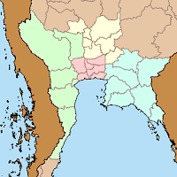
 While the provinces are the top-level administrative subdivision, using larger scale regions especially for statistical purposes is very common. The most common way to divide the country is four regions - North, North-East, Central and South. These regions each have a different geography, the mountainous north, the low river plain of the central, the higher and dryer plateau of the northeast, and the long Malay peninsula. However the boundaries of these regions are not always so clearly defined.
Wolf Donner in the foreword of his 1978 geography monograph "The Five Faces of Thailand" writes
Unfortunately, the definition of "regions", a very important feature in economic geography, has not found mutual agreement between the National Statistical Office (N.S.O.) and the Ministry of Agriculture. The latter confined the North Region to the seven actually mountainous changwats of the north ("Far North"), whereas the N.S.O. included fifteen changwats in the North Region ("Greater North") with obvious effect on the size of the Central Region.and in the note attached to these two sentences
This required much re-calculation when using data from different sources; but the region of reference was not always clear. Confusion became complete when the Ministry of Agriculture and Cooperatives published Agricultural Statistics of Thailand, Crop year 1972/73 in 1974. The former regions (with numbers of changwats) North (7), Central (35), North-East (15) and South (14) had been changed into North (16), North-East (16), Central (9), East (8), West (8) and South (14)...
 The National Statistical Office (NSO) in its 2000 census still uses the same four regions as they were mentioned by Wolf Donner, who was then probably referring mostly to the 1970 census. As the central region in this definition is quite big, it can make sense to subdivide this into the west, east and the central proper, thus making it seven regions altogether. In another book by Wolf Donner, this time in German, he subdivides the central into four subregions, the central proper into the Bangkok Metropolis including the provinces surrounding Bangkok, and a region he named "sub-central". However, his definition differs from the one used in the Thai Wikipedia, which includes Tak (normally a northern province), while Dr. Donner includes Suphanburi and Samut Songkhram.
I don't know whether the NSO will continue to use the four regions in their forthcoming census in 2010, but according to a Thai wikipedian the Ministry of Interior nowadays uses the seven regions, but not being able to read all the MOI publications I could not verify this yet, nor be able to confirm the exact outline of these regions.
Another regional outline was mentioned in the 2Bangkok forum, according to Khun Wisarut it had 9 regions (Phak, ภาค) as the continuation of the Monthon in the years 1934 till 1956. But unlike the Monthon these much less powerful, that's probably why they are almost unknown nowadays. Any further information on these regions would be very welcome.

No comments:
Post a Comment