Friday, January 28, 2011

Model province and district

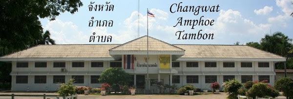
The RCode list of municipality, province and district codes contains two additional codes which seem to make no sense at first look.
9700|จังหวัดจำลอง|
9701|อำเภอเมืองทดสอบ|
There is no province which has the code 97 assigned - Bueng Kan will receive the 38, so it cannot be meant here either - and even more the name of the Mueang district does not match the name of the province.

They only start to make sense once one translates the names of the two entities, then the province becomes "Example province" and the district "Test capital district". As the R in the RCode probably stands for "registration office" I suppose these codes are used for internal tests to avoid bickering with the real registration data.

Thursday, January 27, 2011

Bueng Kan approved by parliament

Yesterday the house of representatives held the 2nd and 3rd reading of the law to create the province Bueng Kan. At 18:20 the 3rd reading was approved by a very solid majority of 342 to 0 votes.

The only steps which are now missing until the province fully becomes reality is the signature by HM the King, and thereafter the publication of the act in the Royal Gazette. Unless it was changed from the draft law, thereafter another 90 days will pass until the law becomes effective and the province is created. Thus if hypothetically the law is already published today, the province will be in effect on April 27.

As I haven't yet found the version of the law approved by parliament, I cannot tell yet if there were any changes to the draft law from November done by the parliamentary commission. Especially if the name was changed from the draft I cannot tell yet, but all the new reports I noticed simply say "จังหวัดบึงกาฬ".

Strangely, none of the English newspaper carried a word on this, even the government news outlet NNT does not mention it - the only parliamentary act they write about are the constitutional amendments which were discussed in 2nd reading before the Bueng Kan act.

Wednesday, January 26, 2011

Census data visualization

It's a pity that Per Henrik writes his blog mostly in Norwegian, so I cannot follow his writings much, but he has some interesting topics on his blog. In his latest posting, he has entered the census data from 1990 and 2000 into a Google spreadsheet to show the automatic diagrams made possible with this - from totally useless ones like the number of Christians in correlation to the percentage of female headed households, but also interesting things like the development of the average household size.
This diagram shows that while for most province the average household size decreased in that decade, it stayed almost constant in the three southern-most provinces, which in 2000 then became the three provinces with the largest household size. Don't know if or how this could be interpreted, and there are probably even more useful possible diagrams within this data. And it will become even more useful once the NSO has published the data of the 2010 census, or Per manages to find the same data from the earlier censuses.

Monday, January 24, 2011

Name of Bueng Kan province

The reporting on the first reading of the Bueng Kan law in parliament included some discussion on the naming of the new province. The draft law, as well as all earlier reporting, named the province simply as Bueng Kan (จังหวัดบึงกาฬ), after the name of the district which will become the capital district.

Bueng Kan is simply the name of a swamp near the small town, meaning "black swamp". Apparently, some consider such a profane name to be not auspicious enough for a province, so I have so far seen two other suggested names.

Mentioned within a news report on the first reading is the name จังหวัดนครบึงกาฬ (Nakhon Bueng Kan province), literally translated "Black Swamp city".

From an historical point of view more appropriate is the other suggested name Chaiburi (จังหวัดไชยบุรี), as that was the name of the district Bueng Kan until 1939 [Gazette]. This name goes back to the Mueang Chaiburi, and was changed as in 1914 the seat of administration was moved from Chaiburi to Bueng Kan [Gazette]. if I am not totally mistaken, the original capital an name-sake is now in Tha Uthen district of Nakhon Phanom province, thus the name Chaiburi for the new province would only be partially fitting as the historical origin would not be part of it.

Which of the names will finally be used will be known soon, as the new parliamentary session has just started, and both the constitutional amendments as well as this province are high on the priority list. I read one report today already which suggests that the province will be in effect in April, thus it must be finalized within the next week.

Friday, January 21, 2011

Data update for amphoe.com?

When I reported on the reappearance of amphoe.com, I mentioned that it still contains the same data as before, which seems to be rather outdated in some parts. But seems like this will change, as on the commands page of the webpage of the Department of Provincial Administration (DOPA) I found one issued by the Office of Strategic and Promotion of District Administration (สำนักยุทธศาสตร์และส่งเสริมการบริหารราชการอำเภอ) on December 30th, which called the district administrators to send data on their district until end of February.

The attached word document has the data to be submitted, which are almost identical to those fields already shown at amphoe.com currently.
  • Name and level of district
  • Slogan of district
  • History of district
  • Address of district office
  • Area in square kilometer
  • Distance from Province center
  • Location (i.e. neighboring districts)
  • Number of subdistricts, villages and households
  • Number of municipalities and TAO
  • Population
  • Ethnicity of population
  • Major occupations
  • Major products
  • Average income
  • Major festivals
  • Number of schools and universities
  • Number of Buddhist temples, mosques, churches
  • Attractions by season
  • Number of hospitals
  • Number of financial institutions, i.e. banks and pawn shops
  • Phone and fax number of district
  • Name of compiler of the data
  • Map of district
  • Photos of district office, historical photos of district office, landmarks, festivals or anything else important for the district
As I guess the original data compilation of amphoe.com was done in a similar way, the data in amphoe.com is of varying quality - sometimes the history is faulty, sometimes the numbers for area contradict with other sources or the number of villages seems wrong. While for things like history, photos, festivals the local officers are probably the better source, I really wonder why these also should fill the statistical data. Things like the population numbers, area, villages, local administrative entities are all available in DOPA itself already, and using these centrally compiled data would ensure the data is of same quality and reference date. An example of a completely filled questionnaire was posted few days ago, showing the data for Ban Lueam district, Nakhon Ratchasima. It seems that in fact most of is found in the PDF is the same which can already be found at amphoe.com, especially the value for the area of 233 km² (145624 rai) is still the same, even though it contradicts with the value I got from the census 2000 data, and also found in the Muban book from DOPA (Page 184 of Issue 1) - both give the number of 218.875 km².

Wednesday, January 19, 2011

Amphur vs. Amphoe

German blogger Noodlegei, who mostly writes on ways to use all the free applications and services from Google, some days ago tweeted a comparison of word occurrences in the Google books corpus. While I had read about this new corpus before, it was this tweet which made me think about using it for similar comparisons within the scope of this blog.

Whereas the word อำเภอ for the Thai districts is usually romanized as "Amphoe" following the RTGS romanization system, still rather popular on websites is the alternative transcription "Amphur" - Googlefight shows them as almost equally popular. But websites, especially with the thousands of copies of Wikipedia, are not that much good as a corpus, the books scanned for Google Books are of a much higher quality. And as a plus the Google Ngram viewer also includes the development over time. For the comparison of Amphoe vs Amphur it shows that the RTGS spelling is slowly becoming the more common one, but due to the rather low number of books containing this term years like 1982 with unusually many publications using Amphoe create a very significant peak, even with the smoothing function.

A second comparison of Muang vs Mueang for เมือง - the second one became the recommended transcription just ten years ago - shows a clear preference for the term Muang, with Mueang rising very slowly. However this comparison is slightly unfair, as there are also placenames where Muang is the official transcription, e.g. Ban Muang district, and also the districts of Laos are usually transcribed as Muang (ເມືອງ).


In German it has the Umlaut characters which fit perfectly the sounds of the two vowel, so for me the most natural way would be to spell them Amphö and Müang. These spellings are really unusual however - Amphö has only some 200 Google website hits, Müng slightly more with about 10.000, and even less when restricting to Google Books. I will of course stay with RTGS despite its shortcomings, and will also try my best to keep the Wikipedia articles to stay with the only standard it has.

Monday, January 17, 2011

How this blog started

On Saturday Wikipedia celebrated its 10th anniversary, growing from an obscure hardly known website where a few nerds wrote about their favorite topics to an outstanding encyclopaedia larger than all the printed ones, and albeit varying quality a website many would terribly miss if it would disappear. When I discovered Wikipedia it was already 2 years old, but still had many areas totally uncovered with articles. And this was how a physicist and software developer became a specialist on territorial administration in far away country.

So when I was starting with Wikipedia, one of the earliest articles I created was the one on my hometown and the district in which it is located. This made me (virtually) meet another editor who systematically started all the districts of Germany, and I joined in doing all those in the Bundesland I live, but finally I did maybe half of the 313 districts of Germany. Being freshly married with a Thai woman, I did the same for her home province Surat Thani, and with the experiences from the German districts I later began to create articles on all Thai provinces as well.

As I knew hardly anything on Thailand at that time, and even less on the administrative system, I had to do a lot of researching to make these articles of an acceptable quality, and also fell into traps like misunderstanding the Mueang districts to be the same as the capital towns. To assist in the collection of the data, I made the first versions of the spreadsheet which has grown a lot since then. Those few English source available on the internet at that time were sometimes rather confusing, but several mentioned the Monthon as a past structure. But as I could not make much sense out of those sources, I finally ordered the Tej Bunnags book "The provincial administration of Siam, 1892-1915" in library which gave me lots of new information, and also made me more interested into the topic.

The next step deeper into the topic began when with the help of a Thai editor the project of having articles on every district in Thailand came into full action - while he translated the content from amphoe.com, I added the population data and the table of subdistricts. After doing them manually for some days I realized that as a programmer I could much easier do a small software to grab the data from the DOPA website and make it into the table ready to insert into the Wikipedia article. At district level the local administrative units TAO and municipality come into focus, a new topic I had not known much about before.

Finally in 2007, I only learned about several changes in the administration late - there was a new minor district in Khon Kaen I didn't know about yet, there was the upgrade of all minor districts to full districts, and also two municipalities in Hat Yai district which had changed status. About all three I only learned more by coincidence. Then I discovered the Royal Gazette online archive, maybe the best source of data I have so far. And shortly thereafter I began with blogging to share my findings.

So Wikipedia not only helped me to learn a lot while researching for writing articles on topics which I was originally interested, it is also to blame for getting me so deep into this obscure topic - but of course I don't regret.