Published on October 1st was the official announcement on the upgrade of the subdistrict municipality Samrong Tai (เทศบาลตำบลสำโรงใต้) to a town municipality (thesaban mueang, เทศบาลเมือง).
This upgrade was just decided in the board meeting of June 24, the announcement was signed on August 20. However the announcement does not state the date the upgrade is taking effect, it only says "ทั้งนี้ ตั้งแต่บัคนี้เป็นต้นไป" which means "effective after this announcement is published". In the board meeting however it was set to be effective on August 7.
As the upgrade was done quite recently, the website of the municipality still shows the term "thesaban tambon" (เทศบาลตำบล) in many places, it seems that so far only the page footer has been changed to "thesaban mueang" (เทศบาลเมือง) already.
Interestingly this upgrade was the latest of the newly created town municipalities, there are still several similar upgrades already decided in the board meetings which however haven't made it into the Royal Gazette - the last similar announcement dates from 2007, so all those upgrades decided in 2008 and 2009 are not yet officially announced.
Thursday, October 8, 2009
Wednesday, October 7, 2009
Urban and rural sanitary districts
I knew that back at the beginning of the sanitary districts in Thailand, there were two kinds of these districts created. At first the urban sanitary districts (สุขาภิบาลเมือง, Sukhaphiban Mueang) in the urban areas, and the rural sanitary districts (สุขาภิบาลตำบล, Sukhaphiban Tambon), both officially codified in law by the 1914 Local Administration Act. As an example, the first rural sanitary district was Tha Chalom, the precursor of the modern day municipality Samut Sakhon, whereas the first urban sanitary district was located within Bangkok. In 1935 all 35 sanitary districts were upgraded to municipalities (Gazette), and for the new sanitary districts created since 1950 I never knew about any distinction between those entities.
But now I found in one section of the book The Management of Secondary Cities in Southeast Asia on the Urban Areas in Nakhon Ratchasima province a list of the various kinds of municipal areas, which includes 17 town (urban) and 20 rural sanitary districts. This book is from 1996, so just few years before the sanitary districts again were all upgraded to full municipalities. Thus these two levels must have been in existence for the second generation of sanitary districts as well, probably this act wasn't amended ever since on this issue. However, all the announcements on the creation of sanitary districts only use the word Sukhaphiban (สุขาภิบาล) without specifying the level, for example the 1956 creation of sanitary district Khanom (Gazette). Thus the thing I need to find now is a list of the 980 sanitary districts with the information of whether they are urban or rural sanitary districts.
But now I found in one section of the book The Management of Secondary Cities in Southeast Asia on the Urban Areas in Nakhon Ratchasima province a list of the various kinds of municipal areas, which includes 17 town (urban) and 20 rural sanitary districts. This book is from 1996, so just few years before the sanitary districts again were all upgraded to full municipalities. Thus these two levels must have been in existence for the second generation of sanitary districts as well, probably this act wasn't amended ever since on this issue. However, all the announcements on the creation of sanitary districts only use the word Sukhaphiban (สุขาภิบาล) without specifying the level, for example the 1956 creation of sanitary district Khanom (Gazette). Thus the thing I need to find now is a list of the 980 sanitary districts with the information of whether they are urban or rural sanitary districts.
Tuesday, October 6, 2009
Mayor elections in Chiang Mai
Courts disqualifying politicians becomes quite a regular thing in Thailand, not only members of parliament, senators or whole parties are disqualified in Bangkok, also local government leaders now often get removed from office in that way. Of those reported here it was the governor of Bangkok who resigned just after his re-election and before court could issue such a demand or the PAO chairman in Surat Thani who then stumbled upwards to become a member of parliament.
Another one I just noticed today was the mayor of Chiang Mai city municipality (เทศบาลนครเชียงใหม่) when reading the results of the election help on October 4. The previous mayor, Duantemduang na Chiang Mai, had to resign after in April a court ruled that she wasn't eligible for election in 2007 because she did not reside long enough in the city. Actually, she did reside there, but the court interpreted the law in such a way that she was required to own a house, the tax receipts were not enough to proof her residence. After some confusion the new elections were finally held last Sunday, and Duantemduang did run again for the post - but not successfully, she only got on 3rd position with just 11.8% of the valid non-abstain votes. The official results as of October 6 are as follows:
Another one I just noticed today was the mayor of Chiang Mai city municipality (เทศบาลนครเชียงใหม่) when reading the results of the election help on October 4. The previous mayor, Duantemduang na Chiang Mai, had to resign after in April a court ruled that she wasn't eligible for election in 2007 because she did not reside long enough in the city. Actually, she did reside there, but the court interpreted the law in such a way that she was required to own a house, the tax receipts were not enough to proof her residence. After some confusion the new elections were finally held last Sunday, and Duantemduang did run again for the post - but not successfully, she only got on 3rd position with just 11.8% of the valid non-abstain votes. The official results as of October 6 are as follows:
| No | Name | Votes | ||
| 1 | ร้อยเอกหญิงเดือนเต็มดวง ณ เชียงใหม่ | Duantemduang na Chiang Mai | 6958 | 11.8% |
| 2 | นายทัศนัย บูรณุปกรณ์ | Tassanai Buranupakorn | 24384 | 41.4% |
| 3 | นายเพทาย เตโชฬาร | Petai Techolan | 1747 | 3.0% |
| 4 | นายวัลลภ แซ่เตี๋ยว | Wanlop Saetiao | 5465 | 9.3% |
| 5 | นายวิชัย วงศ์ไชย | Wichai Wongchai | 1354 | 2.3% |
| 6 | นายพรชัย จิตรนวเสถียร | Phonchai Chitnawasathian | 5524 | 9.4% |
| 7 | นางวิภาวัลย์ วรพุฒิพงค์ | Wipawan Woraputthipong | 13197 | 22.4% |
| 8 | นางอารีย์ อุดมศิริธำรง | Ari Udomsirithamrong | 61 | 0.1% |
| 9 | นายบารมี พจนามธุรส | Barami Photchana | 54 | 0.1% |
| 10 | นายเทพโยธินฐ ไชยรัตน์ | Thepyothin Chairat | 149 | 0.3% |
Monday, October 5, 2009
Paying for jobs
The following quote I found in the 1976 book Modern Thai politics in the introduction to the chapter on national politics.
In recent years, for example, the former Deputy Prime Minister Marshal Prapat had control over the hiring, firing and transferring of provincial governors and district officers. In addition, he controlled hundreds of bureaucratic positions in the Ministry of the Interior. As such, throughout the Kingdom, there were literally thousands of bureaucrats who owed their job to Prapat and who were accountable to him. These persons sent monetary gifts to Prapat and to their more immediate patrons as a sign of gratitude and as insurance that their jobs would remain secure.Praphat Jarusathien (ประภาส จารุเสถียร, 1912-1997) was Ministry of Interior from 1957 till 1973. I don't know whether the described corrupt system was continued after the 1973 revolution, or it was limited to the rule of Praphat as Interior Minister. But it's interested to see that just recently for the 2009 province governor reshuffle such allegations surfaced again.
Google Books
Sunday, October 4, 2009
Municipal decisions from July 20 2009
Meeting number 28 from July 20 2009 with 14 TAO upgraded to subdistrict municipalities.
Friday, October 2, 2009
One Tambon One Photo
 Last month an old fellow from the Thai forums contacted me to discuss his idea of creating a Thailand offspring of Geograph. Geograph is a Web 2.0 project which aims to collect representative photographs and information on every square kilometer of Great Britain and Ireland. The project is very successful, as one can see in the map to the right many areas a fully red, the color chosen for squares having at least one photo. A German offspring has been launched already as well, but there the map is still green almost everywhere - I did not heard about that one before, but now already uploaded some of my photo stock from my home country.
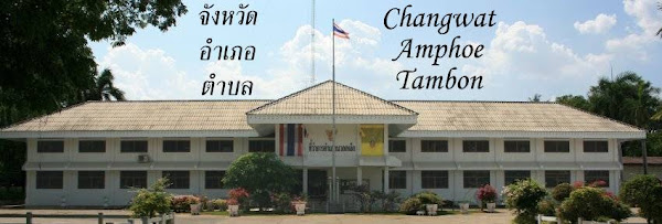
But this blog is on Thailand, and it is just a natural idea to extend this project to more countries, so he had this idea but not the ability to set up and host such a big site. Besides, to make a Geograph Thailand really work it must be bilingual, most Thai would be too shy to contribute on an English only website, and without Thai contributors it will be hard to get much content. So in order to promote this idea and find more co-workers, he instead now started a blog titled "One Tambon One Photo", to collect and present a representative photo for each of the 7255 subdistricts (Tambon). With a daily posting, this blog can run for 19 years without repeating itself, though quite clearly it will get more difficult once the touristic hotspots have been covered. Yet I am sure there are many potential non-Thai contributors who'd like to present their photos from remote places, so this blog could become a fun collaborative project as well as just interesting to read.
Thursday, October 1, 2009
Subdistrict area change in Bang Khae, Bangkok
Among the creations of new subdistricts in Bangkok was one announcement which only changed the outline of the subdistricts without splitting off a new one. In Bang Khae district (บางแค) the boundaries of the three subdistricts were adjusted. The (Gazette) announcement includes a map with the new boundaries, and at the creation of Bang Khae in 1997 the subdistricts boundaries were also defined and displayed on a map (Gazette), so it is possible to compare the two maps and see the changes. I have done an approximate map with Google Maps - whereas the new boundaries are easy as the follow the main roads Phetkasem and Kanchanaphisek and the Khlong Bang Waek, the old boundary of Lak Song subdistrict was not that easy to identify and therefore my map is probably not fully accurate.
The change of boundaries is actually the change of outline of this subdistrict Lak Song, which previously covered the southwestern corner of Bang Khae. The area north of Phetkasem came to Bang Khae Nuea, whereas the area west of Kanchanaphisek road previously belonging to Bang Khae came to Lak Song.
View Khwaeng Bang Khae 2009 in a larger map
As that 1997 map is the oldest I don't know if or how the outline of the subdistricts was changed at that time, the Wikipedia article suggests there were changes at that time as well.
The change of boundaries is actually the change of outline of this subdistrict Lak Song, which previously covered the southwestern corner of Bang Khae. The area north of Phetkasem came to Bang Khae Nuea, whereas the area west of Kanchanaphisek road previously belonging to Bang Khae came to Lak Song.
View Khwaeng Bang Khae 2009 in a larger map
As that 1997 map is the oldest I don't know if or how the outline of the subdistricts was changed at that time, the Wikipedia article suggests there were changes at that time as well.
Subscribe to:
Posts (Atom)