Thursday, December 30, 2010

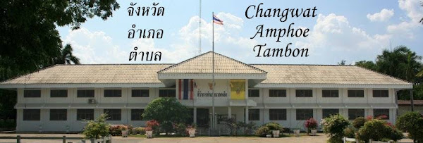
amphoe.com is back

After nearly 3 months of downtime, the website amphoe.com has suddenly come back to life. When I last checked for it mid-December the nameserver was still not responding and thus the site inaccessible, but now yesterday it worked again. Thus apparently the administrator of the nameserver managed to switch it on again, and the website reappeared as nothing ever happened.

Thus the content is the same as before, most notable there are still no entries for the district Galyani Vadhana created one year ago, and even Wiang Kao created in 2006 is still not present. The names of the district officers are more up-to-date, yet the last reshuffle from January 2010 wasn't added yet - for Mueang Surat Thani district amphoe.com still lists Chonosak Wanitcharoen(ชลอศักดิ์ วาณิชย์เจริญ), who is now permanent secretary of Surat Thani province.

Now the site is still working again, maybe I should make a complete mirror for myself, as the next critical point will be the expiry of the domain registration on January 15 - hopefully this time the administrator does the extension early enough and the domain does not fall to a domain grabber. But even then, the site will still be there under the IP address 115.31.184.25 until the actual webserver will be switched off.

Tuesday, December 28, 2010

Om Noi upgraded to city municipality

Yesterday the upgrade of Om Noi town (เทศบาลเมืองอ้อมน้อย), Samut Sakhon province, to a city municipality (เทศบาลนครอ้อมน้อย) was announced in the Royal Gazette, making it the 27th city of Thailand. Same as the municipal announcements last week, this change isn't yet covered by the board meeting transcripts available online, thus was decided after mid-September. The announcement was signed on November 11, which I guess is also the date when the change is effective.

Sadly the announcement PDF does not include the map of the municipality - which is not only included in announcements on area changes, but also when the status is changed without any change of area. Without that map, I only relied on the website of Om Noi which only had a small sketch map, thus it took me some time to find their office in Google Earth.

Om Noi was originally a sanitary district, created in 1967 [Gazette]. In 1994 it was upgraded to a subdistrict municipality [Gazette], and in 2002 to a town municipality [Gazette]. While the sanitary district only covered part of the subdistrict Om Noi, apparently with the upgrade to a municipality the area was enlarged to cover the whole subdistrict.

Thursday, December 23, 2010

Municipal announcements from December 17

Last week, four changes for municipalities were announced in the Royal Gazette, which all took me by surprise as the board meeting transcript did not cover them - so they may have been decided in the board after September 9, which is the latest one currently available. It would fit, as usually the time between board meeting and announcement seems to be something around 3 month, except those cases where it takes way longer without apparent reason.

Wednesday, December 22, 2010

Sanitary districts 1905-1932

As mentioned before, chapter 7 of Thailand: The Modernization Of A Bureaucratic Polity by Fred W. Riggs contains a lot of interesting facts on the administrative subdivisions, so I start with quoting from there with the passage on the sanitary districts (sukhaphiban, สุขาภิบาล), when they where first created.
The first efforts to establish local self-government in Thailand were actually made under the absolute monarchy, long before the revolution of 1932. As early as 1905, an experiment in local self-government was launched with the creation of a sukahpibahn, or "sanitation district," in a commune of Samud Sakorn province, a short distance southwest of Bangkok. Provision was made for the creation of a board all of whose members were appointed ex officio, namely, the village headmen with the commune headman as chairman. (A number of villages or mu ban constitute a commune or tambon, whose head is chosen from among the headmen of the constituent villages.) This board was authorized to collect certain taxes, largely on houses and building construction, to be used for the maintenance of local public works, such as roads, bridges, and lights, and to enforce local sanitation rules in a congested coastal fishing area.

In 1908 and again in 1915, new acts were promulgated expanding the powers of the sukahpibahn, providing that similar boards could be established elsewhere on the recommendation of the provincial governor and the monthon (region) head. By the time of the recolution, it is estimated that there were some forty-five sukahpibahn.
The two acts mentioned are the 1908 sanitary district act and its 1916 amendment.

According to the Royal Gazette announcements, the sanitary districts created after the first one were
  • 1909: Nakhon Ratchasima, Chanthaburi, Songkhla
  • 1910: Phichai (i.e. Uttaradit), Nakhon Si Thammarat, Chonburi
  • 1911: Nakhon Pathom
  • 1912: Phuket
  • 1914: Chiang Mai
  • 1915: Phitsanulok, Ratchaburi, Photharam, Nakhon Sawan
  • 1916: Krung Kao (i.e. Ayutthaya), Song Phi Nong, Ban Pong
  • 1917: Samut Prakan, Saraburi, Lopburi, Prachinburi, Suphanburi, Nakhon Nayok
  • 1918: Singburi, Phichit, Trat, Rayong
  • 1928: Hat Yai
  • 1930: Surat Thani, Phetchaburi, Uthai Thani, Chum Saeng
  • 1931: Trang, Chachoengsao, Ban Mi
These 34 together with Samut Sakhon were all the originally created sanitary districts, as the 1935 Gazette announcement on the upgrade of sanitary districts to municipalities states that out of the 35 (and not 45) entities 32 become town municipalities, two become subdistrict municipalities and 1 (Chiang Mai) becomes a city. Sadly the other 34 sanitary districts are not listed by name in there.

Tuesday, December 21, 2010

License plate images for Chiang Rai and Saraburi

Last Friday, two new provincial license plate graphics were published in the Royal Gazette. Actually, only one is new, as for Saraburi I wasn't able to see any significant difference to an earlier one from 2006. For Chiang Rai, while some elements were reused, the graphic is different from the previous one announced in 2005.

The graphic for Saraburi [Gazette] shows the seal of the province in the middle placed on a large sunflower field. The main symbol of the seal is Wat Phra Phutthabat, the most important temple of the province. Both the temple as well as the sunflower fields are the major tourist attractions of the province. The graphic from 2006 is almost identical, only the colors are less intense.

The graphic for Chiang Rai [Gazette] is dominated by the Phu Chi Fa cliff, from where the sea of clouds can be seen at sunrise if weather allows, with the lower hills peeking through the morning mist. The tower to the left probably refers to Wat Rong Khun. the famous white temple built by renowned artist Chaloemchai Khositphiphat. However the yellow color - the temple is actually bright white - and the clock confuse me a bit. In the 2005 version, this tower wasn't present yet, and the cliff and clouds had a different design. The rising sun was omitted in the new graphic however.

Monday, December 20, 2010

New Google Earth imagery for Thailand

Since Google started to push new imagery to Google Earth twice a month I no longer reported on these updates here, as with the more frequent updates there often were only very few areas in Thailand which received an update, and I also did not want this blog to become just to be yet another Google Earth blog. However, the latest update last week was a really massive one, and not only in Thailand it seems they rolled out much more new data than usual.

Already when the inofficial Google Earth Blog reported the new imagery I noticed areas with new data - either because I could remember the area to have no hires yet, or because I noticed that there were district office locations I had not yet worked into my XML because I could not make out the building in the lores imagery. Most notably, these were parts of Phatthalung province (sadly not yet the town of Phatthalung itself), and an area east of Nan town. But with the official KML where Google marks all the updated areas I learned I found just a small portion of all the changes. In the boundary area to Myanmar in Tak province as well as in Rayong and Chanthaburi at the east coast I could finally get district office location very exact, which are now in my XML and my own KML of administrative offices.

As I mentioned Phatthalung before - while the new hires area comes short of covering the provincial capital, it covers the area between the town and the lake. And while browsing around there, I noticed that it has the old palace of the province governor in there, now yet another item on my long list of places I still want to visit in Thailand. This location also nicely confirms the history of Mueang district - in 1917 the district was renamed to Lampam, the subdistrict where this palace is located. In 1924 however the administration was moved westwards towards the newly built train station.

Friday, December 17, 2010

Ministry of Interior color scheme

In the list of commands from the Department of Provincial Administration (DOPA) to its subordinate offices I found one from November 18 titled การกำหนดสีสัญลักษณ์เพื่อเสริมสร้างภาพลักษณ์ของกรมการปกครอง (Definition of symbol colors for the Ministry of Interior). While the first pages of the PDF are scans, luckily the final pages contain real text and it was therefore possible to do a copy-and-paste to get a quick machine translation.

The two colors are a light blue (dodger blue) and yellow, or with their RGB values 1E90FF and FFFF00. Blue is the color for Friday, as the Ministry of Interior was created on Friday, April 1 1892. It also is the color of credibility, loyalty, coolness and peace, which are the maxims of the MOI. Yellow is of course well-known as the color of HM the King, who was born on a Monday; though this symbol of loyalty to the King has been turned into a political symbol by the PAD and now is no longer purely a royal symbol. Symbolically, the color is supposed to mean friendship, optimism, encourage life and creativity - which are the maxims of the DOPA offices.

More interesting than the symbolism of these colors are the actual orders within this document. This color scheme is supposed to be used in documents like brochures as well as in the various websites. Interestingly as one example amphoe.com is mentioned, even though that site has disappeared even before that document was published. Not sure if this means the disappearance of that site was accidentally and for two months nobody at DOPA noticed it - well, would not be too much surprising if recalling the protecttheking website disaster.

Other places where this color scheme is supposed to be adopted is at district offices, so if a reader happens to see some newly painted fences, flower pots, or other items around the district offices in these colors I'd like to hear - being away from Thailand most of the year I can hardly notice these minor changes myself.