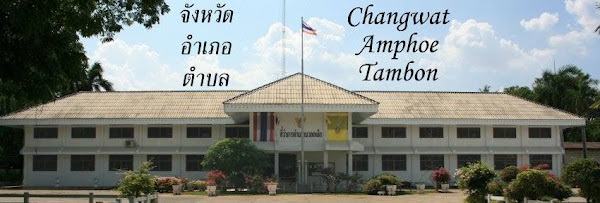
Showing posts with label Amphoe. Show all posts

Monday, August 21, 2017

Census 1937 district data

The 1937 census reports include the male and female population numbers for each district (Amphoe), a table covering 30 pages in the publication. I have now completed to convert these numbers into a spreadsheet, as well as my XML format, of all the 408 districts covered by the report. While I have no idea how much these numbers differed from the real numbers back then due to shortcomings in the way the census was conducted, but the numbers in the report all sum up perfectly except two or three obvious number errors - e.g. for Lang Suan the female population was given as 21893 instead of 12893.

As this table includes a column with the ratio between male and female population, there are some interesting strange cases. While for most district the ratio is between 87% and  130%, there are a few district where the male population is very dominant. Bannang Sata in Yala has more than the double number of men than women (4994 vs. 2427), also Samphanthawong in Bangkok (then Phra Nakhon province) has 42200 men compared to 27760 women. The later case is easy to explain - this district covers Chinatown, which at that time had many unmarried male Chinese workers. This can also be seen in the percentage of Thai vs. non-Thai citizen - Phra Nakhon had 29.7% of non-Thai citizen, Yala 13.4%, also Phuket and Ranong had more than 10%. These two provinces also had quite some Chinese workers, at that time the tin mining was still a big part of the local economy.

Though this table only included the full district and counted the minor districts (King Amphoe) together with the district which supervised it, it also made a good cross-check of whether my district data is complete. From all the districts which exist today, and where I had the dates of when they became full districts, only the district Thung Yai in Nakhon Si Thammarat - then named Tha Yang (กิ่งอำเภอท่ายาง) - was missing, because its upgrade to a full district sometime between 1941 and 1948 apparently wasn't published in the Royal Gazette. The only other special cases are three districts in Bangkok which were abolished later - Bang Sue, Bang Phlat, Bukkhalo and Nang Loeng were abolished in 1938, the first two were created again in 1989. While these districts are included in the data, interestingly the districts already uses the names changed in 1938, which among other changes gave the capital districts the Amphoe Mueang names.


Wednesday, March 22, 2017

Emblem of Amphoe Mueang Surat Thani

As far as I know, it is only the local governments and the provinces which officially have a seal with custom design fitting to the locality. The districts however use the emblem of the Ministry of Interior as their seal - except for the district in Bangkok, which also have custom seals. As I really love these sometimes very artfully designed emblems, it is a pity the websites of the local governments seem to be the only source to get any information on them - if I had the time and the connection I would research and compile much more of them...

Anyway, when I just recently checked the website of Mueang Surat Thani district - one of the few district offices which have their own website - I was surprised to see a emblem for the district.It shows the two main symbolic buildings of the district - the City Pillar Shrine (Sala Lak Mueang) in the city center and the Si Surat Stupa on the hill south of the city. Also the palm farms in the Tapi river estuary and the small boats used in the small channels of the estuary are depicted. I have no idea whether this is just an artful emblem designed for show, or also the official seal of the district - the Google search results for the Thai term ตราประจำอำเภอ don't indicate that any district actually uses a non-standard seal, the only images it returns seem to be very old seals from districts in Ubon Ratchathani province.


Wednesday, March 15, 2017

Districts with just one subdistrict

There are two districts (Amphoe) in Thailand which have just one subdistrict (Tambon), and another four districts in Bangkok (Khet) which have one subdistrict (Khwaeng). As the two kinds of subdistricts are quite different in their functions, I'll write something about the Bangkok districts later.

The two districts are Ko Sichang of Chonburi province - an island off the coast - and Mae Poen in Nakhon Sawan province, a remote part of the province including mountain area. Both district have a quite different history - whereas Ko Sichang already was a minor district with just one subdistrict in 1943, when it was reassigned from Samut Prakan to Chonburi province, Mae Poen was created in 1996, and its single subdistrict Mae Poen was just created shortly before in 1992. Maybe the fact that this district was created directly at the time when the creation of new Tambon stopped altogether explains why it remained with one subdistrict. Looking into the history of other districts, there are a few more which originally had just one subdistrict when they were established as a minor district (King Amphoe).
  • Soeng Sang, Nakhon Ratchasima. Created in 1976 with the single subdistrict Sa Takhian, the second subdistrict was created in 1977. The minor district was upgraded in 1979, and today has six subdistricts.
  • Than To, Yala. Created 1975 with the single subdistrict Mae Wat, the second subdistrict was created in 1977. Today the district has four subdistricts and became a full district in 1981.
  • Pa Daet, Chiang Rai. Created in 1969 with the single subdistrict Pa Daet. In 1970, two new subdistricts were created. 1975 it was upgraded to a full district, and today it has five subdistricts.
  • Ban Kruat, Buriram. Created in 1939 with the single subdistrict Ban Kruat. As the Royal Gazette is unreliable for the subdistrict creations before 1950, I can only say the district was upgraded in 1965 and has nine subdistricts today
Interesting to note - both for Soeng Sang as well as for Pa Daet it was a subdistrict which was named after the district, and not the other way round like for most districts.

I don't know whether there were any official rules predating those defined in 2003 by the cabinet on how many subdistricts are necessary for a new minor district, but even the 2003 rules allowed to overrule the minimum of three if there is a special need for the creation of a new district.

Already before the decentralization with the creation of the Subdistrict Administrative Organizations, the Tambon had a limited local representation of the population by the elected headman. I don't know whether there were any minimum requirements for a subdistrict in terms of population of number of administrative villages, Ko Sichang with a population of less than 5000 people never qualified for a second subdistrict. But its remoteness on an island made sense to have a district office as the government office which normal citizens have to visit most.

Friday, March 10, 2017

Amphoe Kota Baru still on track

I haven't heard anything from the two planned districts to be created in Yala province since 2015, when the government news reported a confusing story which read like they were already created. But since there was no announcement in the Royal Gazette, nor the latest geocode list added any codes for these, they must be still in the pipeline. But even regular searches for any websites mention the names of these two districts return almost nothing, so it felt like the planned might have been abandoned.

But just recently, the Kota Baru municipality (เทศบาลตำบลโกตาบารู) on their Facebook page added photos from a meeting on February 17, in which the location for the new district office was discussed. Sadly, while a photo of the officials inspecting a location was added, which plot of land was inspected or whether it was chosen isn't mentioned. Though I still don't know how what is the schedule for these districts, but at least it seems they are still on track.

Friday, October 14, 2016

District named after members of the Royal family

With the sad passing of HM King Bhumibol - my condolences to all Thai mourning him -, I noticed again that while there are several districts named after members of the Royal family, there so far is none directly named after the late king. There are five districts named Chaloem Phra Kiat (อำเภอเฉลิมพระเกียรติ) which are namedin his honor, as they were created as part of the 50th anniversary of his ascension to the throne, yet their name is not a direct reference to him. While I have no idea why he was not asked to grant his name, or not allowed to grant his name to any district about to be created, I would not be surprised if there will be either a new district created or an existing one renamed as part of the mourning ceremonies.

Using the power of the query engine of Wikidata, its easy to get a list of all the Thai administrative units named after persons, which of course however depends on whether all the Wikidata items have the "named after" property set accordingly. Shortening the list to the districts and those of direct relatives of the late king gives the following list, sorted by the date the districts were created. Interestingly some but not all were directly created as full districts, while other were minor districts at first. Also interesting that his mother and his sister have already two districts in their honor.
  • 2009: Galyani Vadhana, Chiang Mai, named after the sister of the late king
  • 1998: Wachirabarami, Phichit, named after the crown prince and probably next king
  • 1998: Watthana, Bangkok, named after the sister
  • 1996: Srinagarinda, Phatthalung, named after his mother. Royal name was bestowed some month after the minor district was created
  • 1994: Chulabhorn, Nakhon Si Thammarat, named after the youngest daughter
  • 1992: Mae Fa Luang, Chiang Rai, named after his mother
  • 1992: Vibhavadi, Surat Thani, named after the more distantly related Princess Vibhavadi Rangsit
  • 1991: Sirindhorn, Ubon Ratchathani, named after the second daughter
  • 1974: Ubolratana, Khon Kaen, named after the eldest daughter

Wednesday, November 11, 2015

New district in Chumphon proposed

Thai Wikipedia Potapt notified me about a news report that in Chumphon province plans to create a new district. According to that report, the district Tha Sae (อำเภอท่าแซะ) in the north of the province is too large to be manageable by the district office. In fact, this district is the largest one of Chumphon by ara, and also with 83,293 citizen (December 2014) the second-most populous one after Mueang district - interestingly the news report wrongly claims it is the third. Also, its location at the boundary to Myanmar makes it more difficult to administrated. As the name of the new district "Thepharat" (อำเภอเทพรัตน) is proposed.

Interestingly, the territorial extent in this proposal means that not just some subdistricts get split off to form the new district, but also the subdistrict Rap Ro - number five in the map above and the largest of the subdistricts by area, population and number of administrative villages - should be split between the two new districts. The villages 10, 14, 19, 21 and 23 making up the northern part of the subdistrict would become a new subdistrict and then be part of the new district. This would not just make it the first new subdistrict since 1996 (not counting those in Bangkok), it would also mean that the local government of Rap Ro would either be the first TAO to cover area within two districts, or would have to be split as well.

However, it will still take some time until this district can be created - unlike the two proposed districts in Yala province it even hasn't been discussed in the board to consider draft laws nor by the cabinet of ministers, both steps before the law could proceed.

Friday, June 26, 2015

Amphoe created without being King Amphoe

The second issue for the @Amphoe magazine is already available for online reading - hope I can grab a paper copy of this and if possible also the first issue during my forthcoming visit in Thailand - and as a pleasant surprise the amount of English content has increased a lot. Same as in the first issue, the English section "Thing you may not know about Administration" on page 23 is the most interesting, this time it explains that while most Amphoe (อำเภอ, districts) are created as King Amphoe (กิ่งอำเภอ, minor districts), there are a few special cases which were directly created as Amphoe.

Though both King Amphoe and Amphoe are at the same administrative level, the creation of a minor district can be done by a ministerial act, whereas the creation of Amphoe (as well as the upgrade of King Amphoe to Amphoe) need a Royal Act. As the government decided in 2007 to stop using the minor districts to make the administration easier and upgrade all the minor districts to full districts, now all new districts will be created directly as full districts. So far, there was only one, Galyani Vadhana in Chiang Mai created 2009, and probably those two new districts in Yala.

Sadly, the article in this issue however has two problems. Most notably is the fact that the author did not use the official recommended transcriptions of the district names - for example Yasotorn instead of Yasothon - and even within the article uses both "Mueang" and "Mueng". Much less obvious is the claim that the only districts which were created without being King Amphoe are the five Chaloem Phra Kiat districts and four districts named after Royals. I had to check my XML files to confirm that there are more, though not that many. Below is the full list with all cases since the 1932 revolution.
Just hope the editor takes my nitpicking Facebook comment as constructive criticism, as I love to see the topics of this blog getting a somewhat bigger audience with this magazine. And maybe I'll make it into the errata section of the next issue...

Friday, June 19, 2015

New districts in Yala already created?

Amphoe in Yala before the change
number 1 and 6 will change
Checking for any news on the two planned new districts in Yala province, it turned out that only one hit turned up since I was posting about that plan in March. So it seems that not much has happened, but actually that news report by the Public Relation Department dated April 17 says something totally different.

จังหวัดยะลา ได้จัดตั้งอำเภอใหม่ใน 2 อำเภอ คือ อำเภอโกตาบารู แยกจาก อำเภอรามัน และอำเภอลำใหม่ แยกจาก อำเภอเมืองยะลา โดยมีผลตั้งแต่วันที่ 2 เมษายน 2558 นี้
Yala province has created 2 new district named Kota Baru district split from Raman district and Lam Mai district split from Mueang Yala district. Effective April 2 2015.


[...] โดยออกเป็นพระราชกฤษฎีกา (พ.ร.ฎ.) ขณะนี้ เรื่องดังกล่าวจึงยังอยู่ในกระบวนการของกรมการปกครอง
The Royal Decree on this issue is still in processing by the officials.


The article then continues by giving the rationale for this change - both districts having lots of subdistricts and have their population grown, making it more comfortable for the citizen to have the administration split, and finally mentions that the names of these districts are not finalized yet, a royally bestowed name may be chosen instead of using the name of the central subdistrict.

It is a bit strange that this change was so completely unnoticed by any other Thai newspaper, as really no other online resource picked up that report, even on the website of the province a meeting from January is the only google hit. However, I currently cannot access that website, don't know why but for several months already several government websites are inaccessible. I still hesitate to modify the corresponding Wikipedia and Wikidata entries until the Royal Decree has been published, but now have to prepare the vector maps with the new boundaries. And I hope that the Department of Local Administration will update their list of the ccaatt codes soon, right now I had to invent codes for my XML file - I gave Lam Mai the 9509 and Kota Baru the 9510, and kept the subdistrict order same as it were in their previous districts.

Wednesday, March 11, 2015

Two new districts for Yala province forthcoming

The website law.moi.go.th used to be my prime source on planned administrative changes, most notably the municipal upgrades. However, for about a year it seems to offline or at least incredibly slow, so I wasn't able to notice important changes from the board meeting transcripts as I simply cannot even get the overview pages. Today I tried again, and though the website is still same unusable, at least Google had a cached copy of the 2558 board 2 meeting list, and the meeting on January 19 had two very interesting items on its agenda.
๑. ร่างพระราชกฤษฎีกาตั้งอำเภอลำใหม่ จังหวัดยะลา พ.ศ. ....
๒. ร่างพระราชกฤษฎีกาตั้งอำเภอโกตาบารู จังหวัดยะลา พ.ศ. ....
Two new districts were discussed to be created in Yala - Lam Mai (อำเภอลำใหม่) and Kota Baru (อำเภอโกตาบารู). Luckily, the PDF with the transcript is also available through the Google cache, so can extract some details as well. As both Mueang and Raman district have a quite big population - 165,000 and 91,000 respectively - it makes sense to decentralize the central administration in this area. I expect the official announcement in the Royal Gazette soon, so I already prepare to get the Wikidata items in good shape, and having the maps ready...

Friday, December 19, 2014

Subdistrict to be reassigned in Uttaradit

In the cabinet meeting last Tuesday, one of the issues discussed was the reassign of the subdistrict Tha Faek (ตำบลท่าแฝก) from Tha Pla district to Nam Pat in Uttaradit province. To quote from the transcript of the cabinet meeting. Hopefully my translation is not totally wrong.
คณะรัฐมนตรีมีมติเห็นชอบร่างพระราชกฤษฎีกาเปลี่ยนเขตอำเภอท่าปลากับอำเภอน้ำปาด จังหวัดอุตรดิตถ์ พ.ศ. …. ที่สำนักงานคณะกรรมการกฤษฎีกาตรวจพิจารณาแล้ว ตามที่กระทรวงมหาดไทย (มท.) เสนอ แล้วให้ดำเนินการต่อไปได้

มท. เสนอว่า เนื่องจากตำบลท่าแฝก รวม 9 หมู่บ้าน ประชากรรวม 4,441 คน 1,355 หลังคาเรือน อยู่ห่างอำเภอท่าปลา 116 กิโลเมตร ทำให้ประชาชนได้รับความเดือนร้อนไม่สะดวกในการเดินทางไปติดต่อราชการและขอรับบริการงานต่าง ๆ แต่หากเปลี่ยนแปลงเขตการปกครองท้องที่โดยนำตำบลท่าแฝกไปขึ้นกับอำเภอน้ำปาด ซึ่งมีระยะทางห่างเพียง 59 กิโลเมตร อันเป็นการแก้ไขปัญหาความเดือดร้อนดังกล่าวให้แก่ประชาชน จะทำให้ประชาชนได้รับความสะดวกในทุก ๆ ด้าน ทั้งนี้ การโอนตำบลท่าแฝก อำเภอท่าปลา ไปขึ้นกับอำเภอน้ำปาด จังหวัดอุตรดิตถ์ ได้ผ่านความเห็นชอบจากราษฎรในตำบล สภาองค์การบริหารส่วนตำบล ที่ประชุมหัวหน้าส่วนราชการประจำอำเภอทั้งสองอำเภอ สภาองค์การบริหารส่วนจังหวัด และที่ประชุมหัวหน้าส่วนประจำจังหวัดแล้ว
The cabinet has approved the draft decree to change the area of Tha Pla and Nam Pat district, Uttaradit. The Office of Juridical Council has already reviewed the proposal. The Ministry of Interior (MOI) then continued to propose this draft decree.

MOI states that Tha Faek subdistrict covers 9 administrative villages and 4441 citizen in 1355 household. It is located 116 kilometer from Tha Pla district [office] which causes the citizen inconvenience. Nam Pat district [office] is only 59 kilometer away, which will make it more convenient for the people in every aspect. The transfer of Tha Faek from Tha Pla to Nam Pat was already approved by the citizen in the subdistrict, the council of the subdistrict administrative organization, a conference with the section chief of the government offices of both districts, the council of the provincial administrative organization and the heads of the provincial government.
I first read about this proposal in July last year, when it was first discussed in the Board to consider draft laws [Meeting Transcript]. To become effective, this draft decree must be published in the Royal Gazette first, I am not sure whether it needs the formal approval by parliament as well - but given that this parliament is filled with people selected by the same junta choosing the cabinet members I don't expect any larger delays and guess it will come into effect early next year.

Looking at the map, the reason for this change becomes obvious - since the creation of the Sirikit dam in 1974 the area of Tha Faek became even more disconnected from the center of Tha Pla district than it already was before, actually it is surprising it took 40 years to adjust the administration to the changed traffic situation.

Monday, July 8, 2013

Same-named districts

While there are only five districts which have a non-unique name in Thailand - the five Chaloem Phra Kiat districts (อำเภอเฉลิมพระเกียรติ) created in various parts of the country in 1996 - there is one apparent case of two districts with the same name in Phra Nakhon Si Ayutthaya province. Two of the 16 districts of the province are named Bang Sai, but in fact the two districts don't have the same name. The origin of this confusion is the romanization system.
  • Bang Sai (บางไทร), the district with geocode 1404, is pronounced with a short ai (in English the same as in the word I) at end. The name means "Banyan tree village".
  • Bang Sai (บางซ้าย), the district with geocode 1413, is pronounced with a long ai sound at end. The name means "left village" - don't know what left side is meant by the name.
The reason why both districts share the same English name despite having a different Thai pronounciation is simply due to the over-simplification done by the RTGS transcription scheme. This system, the official standard of transcribing Thai to English, has left out not just the tone heights but also the distinction between the short and long vowels. While there is another pair of districts which share the same English name despite having different Thai names - Wiang Sa in Surat Thani (เวียงสระ) and in Nan (เวียงสา), again with different vowel lengths at end - what makes the two Bang Sai so confusing is the fact that they are located within the same province quite close to each other. For example, in Wikipedia the only way to get a unique name for the two district was to add the geocode to the name, so the articles are located at Bang Sai District (1404) and Bang Sai District (1413).

Going down one administrative level, there strangely is just one case where two subdistricts within one district share the same romanization - in Fang district there are two subdistricts named Mae Kha, one with a short a and one with a long one. For villages however, it is quite common to have more than one village with the same Thai name within one subdistrict, which is no big problem since the villages are more often identified by their number than by their name.

For municipalities, it gets much more confusing, as there are cases of two municipalities with the same Thai name in one district, which only differ by the municipal level, so only when using name and administrative status together the name becomes unique. I will write a separate blog post on those cases later.

Monday, December 3, 2012

New district for Chiang Mai

The plan to create yet another new district in Chiang Mai to be named Nanthaburi (อำเภอนันทบุรี) seems to be getting steam. In September, the proposal was submitted to the province governor, who then already gave his support to the plan - and this was renewed by the newly appointed governor as well. End of October, the PAO Chiang Mai also approved the proposal. Today, the strategy group of the province administration (กลุ่มงานยุทธศาสตร์จังหวัดเชียงใหม่) had the proposal on its agenda as well. The report on this meeting says that the proposal will be submitted to the Ministry of Interior soon, proposing to create the district as a special case since it does not match the normal criteria for a new district.
  • a population of at least 25,000
  • at least 4 subdistrict
  • new district office to be at least 20 kilometer away from the district office of the parent district
  • approval by the local government entities affected
The proposed district will have just two subdistricts - Mae Tuen (ตำบลแม่ตื่น) and Mon Chong (ตำบลม่อนจอง) - which together have a population of just 15,388 (as of December 31 2011). I don't fully understand that according to the article today this new district is supposed to be done as part of the 80th birthday celebration of HM the Queen, as that was already in August this year, and the district cannot be created retroactively.

As can be seen in the map, the area of the new district (in red) is very remote not just from the district Omkoi to which it belongs now, it is also about the most remote part seen from the center of the province. Yet even though it is so remote, Google Streetview was already there...

Tuesday, September 18, 2012

New districts proposed

Recently, proposals for new districts showed up in the Thai news. As far as I know, at this time these are just proposals, and it is still completely open if and when these will get officially proposed by the Ministry of Interior to the cabinet, the usual step before an act to create a district is sent to the parliament.

In Chiang Mai, a new district named Nanthaburi (อำเภอนันทบุรี) covering the two subdistricts Mae Tuen and Mon Chong of Omkoi district, is requested by the citizen in this area. With a population of 15,388 and just two subdistricts it does not make the necessary preconditions for a new district, only its remoteness from Omkoi - 76km on a very bad road - may give the proposal more weight. The proposal was received by Chiang Mai governor Mom Luang Panadda Diskul, who promised to raise the topic at the Ministry of Interior. However, few days later his transfer to an inactive post was approved, so his support for the proposal won't help the citizen anymore. However, this district proposal isn't really new, already in 2009 I had stumbled on it and added it into my XML, but sadly didn't kept any of the sources at that time.

Just yesterday, the Board of Directors of the Southern Border Provinces Development Strategy (กรรมการยุทธศาสตร์การพัฒนาจังหวัดชายแดนภาคใต้) has proposed a new district to be created in the province Yala (hopefully my translation of the news report isn't that wrong).
ที่ประชุมยังเห็นชอบในหลักการให้ตั้งอำเภอใหม่ขึ้นอีกแห่งหนึ่งในจังหวัดยะลา โดยรวมพื้นที่บางส่วนของอำเภอเมือง กับตำบลโกตาบารู อำเภอรามัน จังหวัดยะลา ขึ้นเป็นอำเภอใหม่ เนื่องจากเป็นพื้นที่ที่มีปัญหาความมั่นคง มีสภาพเศรษฐกิจและสังคมที่ซับซ้อน รวมทั้งประชากรเพิ่มขึ้น ทำให้การแก้ปัญหา และการพัฒนาไม่เกิดประสิทธิภาพ และประสิทธิผลเท่าที่ควร ซึ่ง กพต.จะมอบหมายให้กรมการปกครอง กระทรวงมหาดไทยดำเนินการต่อไป
Conference approve in principle to set up another new district in Yala province. Some part of Mueang district and Kota Baru subdistrict, Rama district to be raised to a new district. Reasons are that the area have problems with stability, economy and social, which get more complicate with the raising population. To solve the problems and develop efficiently, the board proposes the issue to the Ministry of Interior.
Source: Manager, ทุ่มอีกมหาศาลเอื้อดับไฟใต้ กพต.อนุมัติซื้อ “ชางลี” โรงแรมร้างกลางเมืองยะลา, September 18 2012
Of course I will follow these proposals and report whenever they come closer to get implemented.

Tuesday, February 7, 2012

Ko Tao district proposed

The Thai language news portal of the Department of Public Relations of the Thai government yesterday had an interesting short article, apparently a new district is about to be proposed. As it wasn't found in the English language section, nor have the English newspaper picked up the issue yet, I have to do the translation myself.
Surat Thani province prepares to propose to the cabinet to change administrative status of Ko Tao to District Ko Tao, in order to be more comfortable for the citizen, improve tourism and develop the area to be more effective.

Thirayut Iamtrakun (นายธีระยุทธ เอี่ยมตระกูล), province governor of Surat Thani, disclosed that in the roaming cabinet meeting in Southern Thailand to be held in Phuket in March 2012 the province will ask for approval by the cabinet to set up Ko Tao as a new district, to split from Ko Pha Ngan district. To enhance and support the strategy of the city of good people Surat Thani, including to make it easy for citizen in remote areas to travel to contact with government service conveniently. Additionally, to enhance tourism and develop the area to be more and more efficient.

Ko Tao is an area of about 21 square kilometer or 13,125 rai, mostly hills near the sea, 45 kilometer away from the district [office] Ko Pha Ngan. Divided into one subdistrict and three village and a population of 1706. Most moved there from Ko Pha Ngan and Ko Samui, to make a living in tourism and in services around tourism, as Ko Tao is an important tourist attraction, famous for diving in coral reefs.
[ThaiNews Network, 2012-02-05]
The rules to set up a district could allow the creation of a Ko Tao district (อำเภอเกาะเต่า), as tourism development is mentioned as a major exception from the minimum number of subdistrict.

However, with just 1700 citizen it will be a very small district - even smaller than the currently smallest district Ko Kut in Trat province, which has 2253 citizen in two subdistricts. Since the minor districts (King Amphoe) are no longer existing as a second level of districts, more appropriate for areas to small to get a full district but still have enough local problems to need more direct central administration, now the hurdle for a new second level administration is much higher than it was in past. It will be interesting to see what the cabinet will say about this proposal, so I will certainly pay close attention to the media reports on that Phuket meeting.

Friday, August 26, 2011

Photo albums of administrative offices

Khanom District Office, Nakhon Si Thammarat
For some time I already had started with uploading my photos of the various administrative offices on various web 2.0 sites, but never made it a systematically and complete yet, and never could decide which one to use - Picasa, Panoramio or Flickr, or also Wikimedia Commons. But as with the start of Google+ (thanks to Rikker I am online there already) Picasa effectively dropped their quota and made all images of less than 2048 pixel free - so I can now use that image storage without ever worry about running out of space. I have already uploaded some new photos to the albums below, but still have to go through my archive to complete the albums.


Province HallsศาลากลางAlbum
District Officeที่ว่าการอำเภอAlbum
Province CourtศาลจังหวัดAlbum
Municipal and TAO officesสำนักงานเทศบาล/สำนักงานอบตAlbum
PAO officesสำนักงานอบจAlbum
City Pillar ShrinesหลักเมืองAlbum
The photos are all cc-by-sa, the same license as photos on Wikipedia. So anyone can reuse them, only have to give credit to me as the photographer. And also can upload them to Wikipedia, as I somehow never find the time and mood to fill the more and more bureaucratic forms for a simple upload of a self-created photo.

Friday, June 10, 2011

Amphur Bar & Cafe

I have found the perfect place for the first Changwat Amphoe Tambon blog reader meetup - the Amphur Bar & Cafe in Surat Thani. Only drawback is its location, not just a bit far off in the South of Thailand, but also already a bit outside the town center. And it will be still a long time till this event, as I am already back in Germany when this posting will become public, so no earlier than 2012. And I am still a bit reserved to go to a place which does not use the officical RTGS transcription.

But seriously, the reason for naming this bar Amphur is simply that it is located on the Amphur road (ถนนอำเภอ, literally district road), in the west of Surat Thani city. I have no idea why that street was named this way, as the district office is located on the other side of the city. But the street signs fit perfectly for my blog, now I only have to find a Changwat road and a Tambon road somewhere...

Wednesday, January 19, 2011

Amphur vs. Amphoe

German blogger Noodlegei, who mostly writes on ways to use all the free applications and services from Google, some days ago tweeted a comparison of word occurrences in the Google books corpus. While I had read about this new corpus before, it was this tweet which made me think about using it for similar comparisons within the scope of this blog.

Whereas the word อำเภอ for the Thai districts is usually romanized as "Amphoe" following the RTGS romanization system, still rather popular on websites is the alternative transcription "Amphur" - Googlefight shows them as almost equally popular. But websites, especially with the thousands of copies of Wikipedia, are not that much good as a corpus, the books scanned for Google Books are of a much higher quality. And as a plus the Google Ngram viewer also includes the development over time. For the comparison of Amphoe vs Amphur it shows that the RTGS spelling is slowly becoming the more common one, but due to the rather low number of books containing this term years like 1982 with unusually many publications using Amphoe create a very significant peak, even with the smoothing function.

A second comparison of Muang vs Mueang for เมือง - the second one became the recommended transcription just ten years ago - shows a clear preference for the term Muang, with Mueang rising very slowly. However this comparison is slightly unfair, as there are also placenames where Muang is the official transcription, e.g. Ban Muang district, and also the districts of Laos are usually transcribed as Muang (ເມືອງ).


In German it has the Umlaut characters which fit perfectly the sounds of the two vowel, so for me the most natural way would be to spell them Amphö and Müang. These spellings are really unusual however - Amphö has only some 200 Google website hits, Müng slightly more with about 10.000, and even less when restricting to Google Books. I will of course stay with RTGS despite its shortcomings, and will also try my best to keep the Wikipedia articles to stay with the only standard it has.

Thursday, August 12, 2010

100th anniversary of Tak Bai district

The district Tak Bai in the southernmost province Narathiwat did just celebrate its 100th birthday. I only became aware of this event by an article in the official news published by the Public Relations Department on the last day of the ceremonies. Titled Narathiwat province district celebrates 100th anniversary, it only mentions the base of the celebrations with a single sentence
The 100th anniversary commemorates the district which played an important part in preventing the country being colonized by the British during king Rama the 5th’s rule.
On the video channel of The Nation, it also has a video on the celebrations.

But much more interesting than the celebrations is the actual history of the district and the events which led to the creation of the district in 1909. On March 10 1909 the Anglo-Siamese Treaty was signed, which finalized the boundary between Siam and the British colony Malaysia. The area of Tak Bai belonged to the Mueang Kelantan, but since the boundary was chosen to run along the Kolok river this part of Kelantan became part of Mueang Bang Nara, the old name of Narathiwat province. In August the territorial administration of the area was defined. Published on August 22 in the Royal Gazette was an announcement titled ประกาศกระทรวงมหาดไทย ประกาศตั้งอำเภอสะเดาและอำเภอตากใบ, which was signed on August 12. Sadly it does not state on which day it became effective, but since the celebrations ended on August 10 it must have been few days before the announcement was signed.

Those who can read Thai will notice, that together with Tak Bai also the district Sadao was established, as here part of Mueang Saiburi (Kedah) was added to Songkhla. But I am not aware of any celebration in there, but since it was announced at same date it should have its anniversary at the same time.

According to the data I have, the next district to celebrate its 100th anniversary is Rueso, also in Narathiwat, which was created as a minor district on September 24 1913 [Gazette]. If however only the full district status counts, then the next are already next month - Wiang Sa and Rong Kwang were upgraded from minor districts to full districts on September 12 1909 [Gazette].

Friday, June 25, 2010

District levels

When I looked around on the website of the Surat Thani provincial office of the Department of Provincial Administration (DOPA), one post in the forum caught my attention. Posted in January already and not receiving any answer by the webmaster the question reads
ไม่ทราบว่าหลักเกณฑ์การแบ่งเขตอำเภอของจังหวัด สุราษฎร์ว่าเป็นอำเภอขนาดเล็ก กลาง ใหญ่
หน่วยงานไหนเป็นผู้รับผิดชอบ ใครทราบช่วยบอกหน่อย เพราะต้องการข้อมูลทำวิทยานิพนธ์ด่วย
If I understand it correctly, the poster asks for the rules of the categorization of districts into small, medium and large, and which authority is responsible for this.

Last year I posted about district levels already, however at that time I found five levels, which seemed to be about the economic strength as well as population of the district. Trying to find more on the above mentioned three levels, I could find at DOPA a list of award winning district offices in the three categories - each with several photos of the inside of the district office. The one of Phachi district, Ayutthaya province, even includes a photo of the award badge.

At the website of Nakhon Pathom provincial office of local administration a news report lists the districts of this province with their category.
อำเภอขนาดใหญ่LargeMueang Nakhon Pathom, Sam Phran
อำเภอขนาดกลางMiddleNakhon Chaisi, Kamphaeng Saen, Bang Len
อำเภอขนาดเล็กSmallDon Tum, Phutthamonthon

Now, since there were the district office awards issued according to these three levels, I checked the report I wrote on this award last year. It also had three district levels then, and also listed the population numbers which qualify the three levels. Just sadly this does not fit with the district of Nakhon Pathom - as the levels change at 50,000 and 80,000, the three middle class districts should be at the highest level as well.

Friday, June 11, 2010

Districts named after Royals

As Thailand is a monarchy and quite the majority is royalist, it's no wonder this love or respect towards the royal family also shows in several geographical entities named after them. Interestingly, only dams have been named after HM the King or the Queen, but none of the districts. But several other members of the royal family have given their names to a district in their honor.

At first, there are the three daughters of the royal family, each having one district named after them.
However none is named after the Crown Prince Vajiralongkorn, but I don't know the reason.

Other members of the royal family have already been honored by district names. The older sister of the King, Princess Galyani Vadhana, had lend her name to the district Watthana in Bangkok, and of course also the recently new district Galyani Vadhana in Chiang Mai is of course also named after her. Also the mother of the King has a district named after her - Mae Fa Luang district in Chiang Rai, the name she was most well-known to the hill-tribes in the north. Also, the district Srinagarindra in Phatthalung is named in her honor. A more distant member of the family, Vibhavadi Rangsit has been honored by the district Vibhavadi in Surat Thani province, not that far from where she died when rebels shot down her helicopter in 1977.

One further district is named after a royal, Phaya Mengrai district is named after the founder of the Lanna kingdom of northern Thailand, 700 years ago. Unless I forgot one, the only other central government entity named after a person was the province Phibun Songkhram, the Cambodian province Siem Reap while it was annexed during World War II, named after the prime minister and military dictator of that time.